

Paraic Quirke, Director – Head of Infrastructure & Natural Environment at Murphy Geospatial, a Woolpert Company
In the construction and maintenance of key infrastructure, such as roads, rail, and active travel schemes, UAV surveys or drone mapping have emerged as indispensable services. However, some persisting misconceptions about how to use a UAV survey and when it’s appropriate mean that this valuable option is potentially untapped.
Unlocking precision with UAV surveys and drone mapping
UAV surveys, also known as drone surveys, and drone mapping involve the use of Unmanned Aerial Vehicles (UAVs) equipped with cutting-edge technology to capture high-resolution aerial imagery of construction and operational sites. This method provides a wealth of benefits that can be used on its own or complemented by other surveying techniques, such as mobile mapping.
Are drone surveys accurate?
Drone mapping stands out for its ability to deliver precise and detailed site surveys at scale, a game-changer for infrastructure projects. Contrary to common misconceptions, not every survey demands a 1mm precision level. In reality, a range of 15-20mm, achievable through the use of UAV and appropriate ground control, is often more than sufficient for the intricacies of many road and rail civil engineering projects. With a greater range of data gathered, you can then be strategic in deploying more detailed, and therefore more costly, methods of surveying, which helps to streamline your budgets.
Accessing inaccessible, hard-to-reach, hazardous sites with a UAV survey
Infrastructure projects frequently encounter challenges posed by hard-to-reach or hazardous sites. Enter drones – these unmanned marvels can effortlessly navigate through areas that are otherwise challenging or perilous, capturing crucial data without compromising safety. Using UAV LiDAR technology to explore these inaccessible areas results in a comprehensive overview of the site without putting human lives at risk.
Projects, like road construction sites with ongoing traffic, enforce a no-fly zone for drones. Nevertheless, this restriction shouldn’t stop you from collecting vital geospatial data. UAV survey data from surrounding regions can be integrated with information from various sources, like point cloud data acquired by a mobile mapper, to produce a comprehensive model of your site.
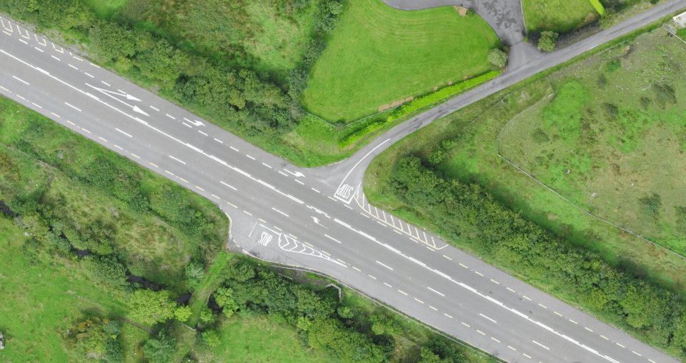
Digital twins and drone mapping
Drone surveys can play a pivotal role in creating accurate digital twins of construction sites. This virtual replication of the physical environment saves time, cuts costs, and promotes safer operations. Regular flight operations provide near-real time data sets which enable informed decisions to optimise project programme and cost with the added benefit of a historical record of progress. The benefits extend beyond visualisation, enhancing collaboration among project stakeholders and facilitating better decision-making.
Bridging the gap between appearance and accuracy: the role of geospatial experts
Capturing and processing data through drone mapping is best undertaken by trained professionals. Once gathered, that data needs the expertise of geospatial specialists to be interpreted correctly. These highly trained individuals ensure that what looks good visually aligns with geospatial correctness. Their role is indispensable in transforming raw data into actionable insights, guiding the project with precision.
Maximising efficiency and increasing collaboration to achieve better results
Our drone surveys go beyond capturing data – they unlock efficiency. UAV surveys are also great collaborators with other survey methods, providing fantastic contextual information for better informed decisions. As an example, recently we worked alongside our teams of experts in survey control, topographical and hydrographic survey teams to capture geospatial data needed to create a digital representation of the proposed route of the upgrade of motorway junctions in South County Dublin and Co. Wicklow. Engaged by the National Transport Authority, the survey needed to be as unintrusive as possible, which is why UAV surveying was one of the selected methods we deployed. A combination of UAV survey, mobile mapping, SX10 laser scanning and traditional topographical survey techniques were used to collect all the required information.
By accurately mapping the terrain using UAV surveys, whether on their own or alongside other survey methods, we can create a digital representation of a project throughout its lifecycle. This digital asset can be used and interacted with by multiple operatives, leveraging the value of the data, which not only saves time and costs but also promotes safer operations. This efficiency translates into overall better results in the management of your assets.
When deployed correctly, by trained individuals with the understanding of the data output, UAV surveys can shift the dial on infrastructure projects for our clients, regardless of when they are engaged in the project life cycle.
Find out more about our UAV surveys here.