
SERVICES
Geographic Information Systems (GIS)
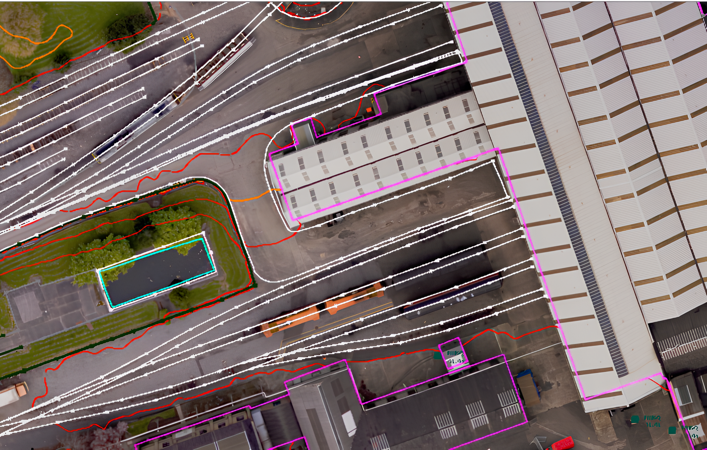
Geographic Information Systems (GIS) is a system that creates interactive maps to better understand patterns, trends, and relationships in spatial or geographic data.
At Murphy Geospatial, we recognise the vital role that GIS play in a number of industries such as utilities, environmental management, energy and property. Our goal is to provide comprehensive solutions which enhance decision making and improve operational efficiency.
GIS platforms help us to mitigate the environmental impact generated by site-based activities. By enabling cloud-based collaboration and promoting remote data analysis, we reduce the need for travel, propelling our drive towards a more sustainable future.
Our extensive knowledge in all aspects of geospatial surveying forms the backbone of our GIS services. This industry leading expertise ensures that the data we collect and analyse is accurate, reliable and actionable; providing geospatial certainty you can trust.
Essential for tasks such as site selection, environmental impact assessments and resource management, the unique needs of our clients are fulfilled in various ways including real world spatial analysis to help gain an understanding and interpret complex geographic data.
Planning, design and construction projects benefit from our advanced modelling solutions enabling clients to visualise their projects in three dimensions, providing an immersive walkthrough, backed up by geo-referenced point clouds for accurate data analysis.
We ensure that assets are surveyed, mapped, photographed and identified with condition and relevant metadata. This level of detail supports better asset management allowing maintenance planning, risk assessments and data-driven decision making.
Murphy Geospatial have developed a proprietary portal and cloud hosting solution, ensuring that clients have secure, reliable access to their GIS data for frictionless data sharing and collaboration.
What are the benefits of GIS?
- Reduces carbon footprint through cloud-based collaboration.
- Increases efficiency through streamline workflows and processes, saving time and cost.
- Enables better asset management through data-driven decision making.
- Improves decision-making through integration of various data sources
- Enhances planning and resource management for land, water, and infrastructure.
- Better understanding of spatial relationships between different features; allowing for better analysis and visualisation of data.
- Strengthens emergency response and disaster management through real-time information to help coordinate and respond to emergencies effectively.
What can GIS be used for?
To improve planning, maintenance, and asset management.
To assist with site selection, market analysis, and property valuation.
To better understand, manage, and protect natural environments.
For planning, management and improving efficiency of energy infrastructure.
To streamline operations and workflows and, improve asset management.