SECTOR

Industrial
& Power_

industrial and power surveying sector

Overview_

In the industrial and power sector access to accurate geospatial information is critical to ensure that stakeholders can work around assets without causing damage or disruption to the millions of customers they serve. 

Our specially trained and certified surveyors have sector-specific experience that enables us to access and work safely around hazardous environments on some parts of this sector infrastructure. Ensuring that projects can be delivered accurately, safely, on program and on budget. 

OIL & GAS

Surveying and Geospatial Data are an important aspect of the oil and gas industry as they provide detailed information about the physical layout and construction of existing facilities.
This information is critical for several reasons including safety, compliance, asset management, project management and legal matters. The surveys play a critical role in the safe, efficient, and compliant operation of oil and gas facilities, and are essential for the management and maintenance of these assets.

 Stock image displaying industrial location of oil and gas station.

Our solutions_

GEOSPATIAL CONSULTING

Our Geospatial Consultancy provides our clients with the expertise on geospatial technologies and processes to enable them to leverage accurate and timely location-based data. We provide oversight and management to ensure accuracy and compliance of geospatial data. Our services provide data collection and analysis, mapping and visualization, custom software development, needs assessment and system design, and project management.  

Our consultants work with clients across various industries, such as government, transportation, energy, environmental management, real estate, and urban planning. 

The benefits of geospatial consulting include improved decision-making, enhanced efficiency and productivity, reduced risk, and better understanding of the spatial relationships and patterns that underlie complex problems. Geospatial consulting can also help organizations stay up to date with the latest trends and technologies in the field and identify new opportunities for growth and innovation.

  • Geospatial Consulting 
  • Geospatial Management 
  • Mapping- Above and below ground 
  • As-builts- Digital twin 
  • Monitoring 
  • GIS 
  • Feasibility studies  
Geospatial-Consulting

GEOSPATIAL MAPPING

In order to give complete records and information on an asset for everything from data analysis to design to support in digital construction workflows, we gather spatial data of new and existing assets.   

The mapping process typically involves collecting data on the location and characteristics of the asset, such as its size, shape, and features, and then creating a digital representation of the asset on a map. This allows for better understanding of the asset’s location, its relationship with other assets or features in the surrounding area, and its potential impact on the environment. 

Geospatial mapping of an asset can have various applications, including in urban planning, environmental monitoring, disaster management, and asset management. It can provide valuable insights for decision-making and planning, such as identifying potential risks and opportunities, assessing the impact of infrastructure projects, and improving the maintenance and efficiency of assets. 

  • Survey Control  
  • Topographic Mapping 
  • Geophysics 
  • Utility Mapping 
  • Route optimization 
  • As-builts 
  • Reality Capture 
  • 3D modelling – GeoBIM 
  • GIS 
  • Site Verification 
Maping

GEOSPATIAL ENGINEERING

Our expert geospatial engineers ensure correct co-ordination and layout of your construction and refurbishment projects and act as the critical interface between digital design and on-site reality.  Geospatial engineering for construction can provide valuable insights for project planning and design, including identifying potential risks and opportunities, assessing site suitability and feasibility, and optimizing construction methods and materials. During construction, geospatial data can be used to monitor progress and ensure compliance with design specifications and environmental regulations.

Examples of geospatial engineering applications in construction include site analysis and selection, topographic mapping, land surveying, 3D modelling, and environmental impact assessments. Geospatial engineering can help construction companies and engineers to save time and costs, improve safety and accuracy, and enhance the sustainability and resilience of their projects.

  • Survey Control
  • Setting Out
  • As-Built Verification
  • Progress Visualisation
  • NDT Surveys
  • Geospatial Management
  • GIS
  • Clash Detection
  • 3D Modelling- GeoBIM
Geoaspatial-Engineering

Asset Management

Asset management is crucial for buried utilities as it allows utilities companies to keep track of the location, condition, and maintenance needs of their underground assets, such as pipelines and cables. Effective asset management helps to reduce the risk of failure or service disruptions, optimize maintenance schedules, and plan for upgrades or replacements. By leveraging tools like GIS mapping and asset management software, utilities companies can ensure that their buried assets are properly maintained, minimize the risk of environmental damage, and improve the overall efficiency of their operations. 

  • Survey Control 
  • Setting Out 
  • As-Built Verification 
  • Progress visualisation 
  • GIS 
  • Utility Mapping 
  • Route optimization 
  • 3D Modelling- GeoBIM 
  • Augmented Reality Capture 
Investigation

UTILITIES

Spatial data of survey information is crucial for the planning, designing, and construction of new power plants and stations, as well as for the maintenance and repair of existing infrastructure. Therefore, to reduce project risk and enhance project design it is importance to undertake surveys at the pre-design stage and post construction stage of any project. Utilities companies use geospatial data to keep track of the location and condition of their assets, such as power lines, transformers, and buried infrastructure. This allows them to monitor maintenance needs and plan for upgrades or replacements. Our mapping services helps utilities companies to plan and design their intrastructure in a way that maximizes efficiency and minimizes environmental impact. By leveraging the power of geospatial data, utilities companies can improve their operations, reduce costs, and provide better service to their
customers.


Our solutions_

GEOSPATIAL CONSULTING

Our Geospatial Consultancy provides our clients with the expertise on geospatial technologies and processes to enable them to leverage accurate and timely location-based data. We develop a bespoke geospatial management plan that detail out specific process and standards to ensure geospatial data is verified and trusted.

  • Asset Management
  • Geospatial Management
  • Survey Control
  • As-built Verification
  • Progress visualisation
  • Virtual tours
  • GIS
  • Feasibility studies
Geospatial-Consulting

GEOSPATIAL MAPPING

We collect spatial data of new and current assets in order to provide comprehensive records and information on an asset for anything from data analysis to design to support digital processes. This includes 3D data for design and accurate mapping of buried utilities to prevent service strikes.

  • Survey Control Networks
  • Topographic Mapping
  • Drone Surveys
  • Wayleave mapping
  • As-built surveys
  • Legal/ Boundary mapping
  • Geophysics
  • Utility Mapping
  • Reality Capture
  • 3D modelling – GeoBIM
  • GIS
  • Site Verification
Maping

GEOSPATIAL MANAGEMENT

In order to ensure that all geospatial activities are carried out strictly in line with our custom Geospatial Management Plans, our experienced Geospatial Managers supervise on-site activities and validate and verify geospatial data. This assures consistency, accuracy, and conformance to BEP and AIM criteria for all spatial data.

  • Geospatial Consulting
  • Project Management
  • Utility Mapping
  • As-builts
  • Monitoring
  • Construction
  • GIS
Geospatial-Managment

GEOSPATIAL ENGINEERING

We provide engineering and consultancy support on projects at all stages through the project lifecycle. Our Geospatial Engineering solutions will ensure correct co-ordination and layout of your construction and upgrade projects and compliance to programme.

  • Survey Control
  • Setting Out
  • As-Built Verification
  • Progress visualisation
  • GIS
  • NDT Surveys
  • Asset Management
  • Utility Mapping
  • Route optimization
  • 3D Modelling- GeoBIM
  • Clash Detection
Geoaspatial-Engineering

Asset Management

Asset management is crucial for buried utilities as it allows utilities companies to keep track of the location, condition, and maintenance needs of their underground assets, such as pipelines and cables. Effective asset management helps to reduce the risk of failure or service disruptions, optimize maintenance schedules, and plan for upgrades or replacements. By leveraging tools like GIS mapping and asset management software, utilities companies can ensure that their buried assets are properly maintained, minimize the risk of environmental damage, and improve the overall efficiency of their operations.

  • Survey Control
  • Setting Out
  • As-Built Verification
  • Progress visualisation
  • GIS
  • Utility Mapping
  • Route optimization
  • 3D Modelling- GeoBIM
  • Augmented Reality Capture
Investigation

DATA CENTERS

Data Centers have unique characteristics that often have very specific geospatial requirements.

From the complexity of utilities into the site, to the precise location and spacing of servers and supporting infrastructure and also the drive for offsite (MMoC) manufacture of key components.

Our solutions in this space ensure our clients can proceed with confidence and make informed decisions based on reliable location and measurement information.

Server racks in server room data center. 3d render

Our solutions_

GEOSPATIAL CONSULTING

Our Geospatial Consultancy provides our clients with expertise on geospatial technologies and processes to enable them to leverage accurate and timely location-based data. We provide oversight and management to ensure accuracy and compliance of geospatial data. 

  • Geospatial Consulting
  • Geospatial Management Plan
  • Survey Control
  • Topographic Mapping
  • Legal/ boundary surveys
  • Utility Mapping
  • Geophysics
  • GIS
  • Data Management
  • Feasibility Studies
Geospatial-Consulting

GEOSPATIAL MAPPING

We collect spatial data of new or existing structures or assets in order to provide comprehensive records and information on an asset for anything from data analysis to design to support digital ways of working and Modern Methods of Construction. 

  • Geospatial Consulting
  • Geospatial Management Plan
  • Survey Control
  • Topographic Mapping
  • Legal/ boundary surveys
  • Utility Mapping
  • Geophysics
  • GIS
  • Data Management
  • 3D Modelling- GeoBIM
  • Site verification
Maping

ASSET MANAGEMENT

Asset management is crucial foe Data Centres to keep track of the location, condition, and maintenance needs of their assets, such as pipelines and cables. Effective asset management helps to reduce the risk of failure or service disruptions, optimize maintenance schedules, and plan for upgrades or replacements. By leveraging tools like GIS mapping and asset management software, utilities companies can ensure that their buried assets are properly maintained, minimize the risk of environmental damage, and improve the overall efficiency of their operations.

  • Survey Control
  • Setting Out
  • As-Built Verification
  • Progress visualisation
  • GIS
  • Utility Mapping
  • Route optimization
  • 3D Modelling- GeoBIM
  • Augmented Reality Capture
Asset-Management

GEOSPATIAL ENGINEERING

We provide engineering and consultancy support on projects at all stages through the asset lifecycle. Our Geospatial Engineering solution will ensure correct co-ordination and layout of your construction and upgrade projects and compliance to programme.

  • Survey Control
  • Setting Out
  • Route Optimization/ Clash Detection
  • Utility Mapping
  • Reality Capture
  • As-Built Verification
  • GIS
  • 3D Modelling – GeoBIM
Geoaspatial-Engineering

Geospatial Management

Engage us as geospatial managers to enhance, plan, and train project stakeholders as well as govern geospatial data to motion progress and enable informed decisions. De-risk your project by utilising geospatial experts that understand your needs, the complexity of your project conditions while developing solutions that bring the most gains to your team.

  • Geospatial Management
  • Data Management
  • Onboarding and Training [For sub-contract partners]
Geospatial-Managment

RENEWABLES

When designing solar or windfarms, it is important in any design process to undertake surveys of the proposed site to ascertain the ground conditions. The surveys are an important tool for understanding the subsurface conditions at a proposed wind farm site, and for identifying and addressing any potential issues that could affect the safe and efficient operation of the proposed solar or wind farm, furthermore, mapping potential solar farms helps to identify suitable locations for solar energy production. This involves analysing factors such as solar irradiation levels, land availability, and proximity to existing power infrastructure, among others. Identifying suitable locations can help ensure that solar farms are established in areas with the most favourable conditions for solar energy production.
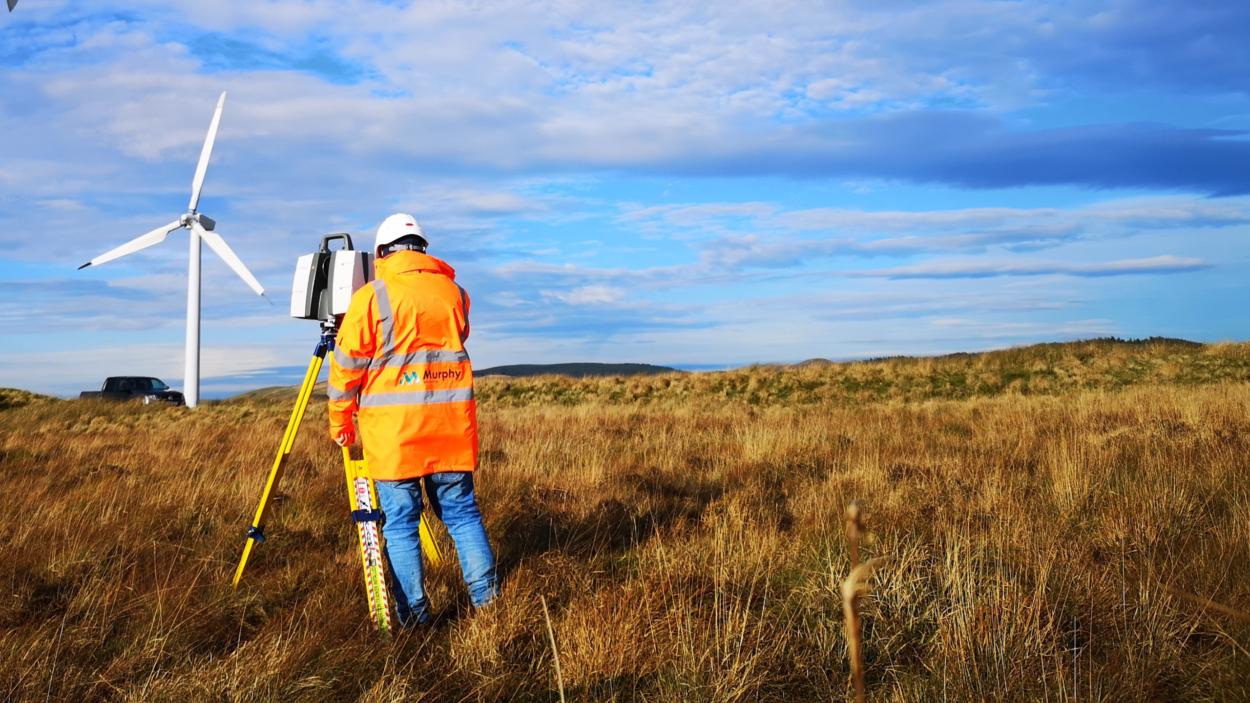
Surveyor and equipment - renewable

Our solutions_

GEOSPATIAL CONSULTING

Our Geospatial Consultancy provides our clients with the expertise on geospatial technologies and processes to enable them to leverage accurate and timely location-based data. We develop a bespoke geospatial management plan that detail out specific process and standards to ensure geospatial data is verified and trusted.

  • Geospatial Consulting
  • Geospatial Management
  • Progress visualisation
  • Legal/ Boundary surveys
  • Topographical mapping
  • Utility Mapping
  • Geophysics
  • Feasibility studies
Geospatial-Consulting

GEOSPATIAL MAPPING

We collect spatial data of new and current assets in order to provide comprehensive records and information on an asset for anything from data analysis to design to support digital processes. This includes 3D data for design and accurate mapping of buried utilities to prevent service strikes.

  • Survey Control Networks
  • Geophysical mapping
  • Topographic Mapping
  • Utility Mapping
  • Reality Capture
  • 3D modelling GeoBIM
  • Drone Surveys
  • GIS
  • Site Verification
Maping

GEOSPATIAL MANAGEMENT

In order to ensure that all geospatial activities are carried out strictly in line with our custom Geospatial Management Plans, our experienced Geospatial Managers supervise on-site activities and validate and verify geospatial data. This assures consistency, accuracy, and conformance to BEP and AIM criteria for all spatial data.

  • Project Management
  • Geospatial Management Plan
  • GIS
  • Consultancy
Geospatial-Managment

GEOSPATIAL ENGINEERING

We provide engineering and consultancy support on projects at all stages through the project lifecycle. Our Geospatial Engineering solutions will ensure correct co-ordination and layout of your construction and upgrade projects and compliance to programme.

  • Survey Control
  • Setting Out
  • As-Built Verification
  • Progress visualisation
  • GIS
  • Asset Management
  • Utility Mapping
  • Route optimization
  • 3D Modelling- GeoBIM
Geoaspatial-Engineering

NUCLEAR

Surveying in a nuclear power plant at preconstruction and post construction stages can provide several benefits, including:

Safety: By regularly surveying and inspecting utility systems, potential safety hazards can be identified and addressed before they lead to an incident thus reducing project risk.

Asset Management: By surveying the utilities it can be better understood the usage, performance and capacity of the utilities, and the maintenance plan can be optimized accordingly.

Our experience, training and certifications in this space ensure our clients can rely on us to deliver vital information in a fully compliant workflow.

Nuclear power station

Our solutions_

GEOSPATIAL CONSULTING

Our Geospatial Consultancy provides our clients with the expertise on geospatial technologies and processes to enable them to leverage accurate and timely location-based data. We develop a bespoke geospatial management plan that details specific process and standards to ensure geospatial data is verified and trusted. 

  • Geospatial Consulting
  • Geospatial Management
  • Primary Control
  • Geophysics
  • Setting Out
  • As-built Verification
  • Progress visualisation
  • Virtual tours
  • Feasibility studies
Geospatial-Consulting

GEOSPATIAL MAPPING

We collect spatial data of new and current assets in order to provide comprehensive records and information on an asset for anything from data analysis to design to support digital processes. This includes 3D data for design and accurate mapping of infrastructure and utilities on site.

  • Survey Control Networks
  • Topographic Mapping
  • Utility Mapping
  • Geophysics
  • Legal/ boundary surveys
  • Site Verification
  • NDT
  • Reality Capture
  • 3D modelling (AutoCAD/Revit/Inventor/Smartplant3D etc)
Maping

GEOSPATIAL MANAGEMENT

In order to ensure that all geospatial activities are carried out strictly in line with our custom Geospatial Management Plans, our experienced Geospatial Managers supervise on-site activities and validate and verify geospatial data. This assures consistency, accuracy, and conformance to BEP and AIM criteria for all spatial data.

  • Geospatial Consulting
  • Geospatial Management
  • Mapping
  • Monitoring
  • Construction
  • Building Surveying
Geospatial-Managment

GEOSPATIAL ENGINEERING

Our Geospatial Engineers have experience in working on high rise and modular buildings. Axial Shortening, Vertical Control and Lift Core structural monitoring are all critical elements to ensure that high rise buildings can be built to tolerance and preventing associated issues during construction.

  • Survey Control
  • Setting Out
  • As-Built Verification
  • Progress visualisation
  • Lift Jack monitoring
  • Axial Shortening
  • Setting out for Modular construction.
Geoaspatial-Engineering

Asset Management

Asset management is crucial to keep track of the location, condition, and maintenance needs of their underground assets, such as pipelines and cables. Effective asset management helps to reduce the risk of failure or service disruptions, optimize maintenance schedules, and plan for upgrades or replacements. By leveraging tools like GIS mapping and asset management software, utilities companies can ensure that their buried assets are properly maintained, minimize the risk of environmental damage, and improve the overall efficiency of their operations.

  • Survey Control
  • Setting Out
  • As-Built Verification
  • Progress visualisation
  • GIS
  • Utility Mapping
  • Route optimization
  • 3D Modelling- GeoBIM
  • Augmented Reality Capture
Investigation

HYDRO

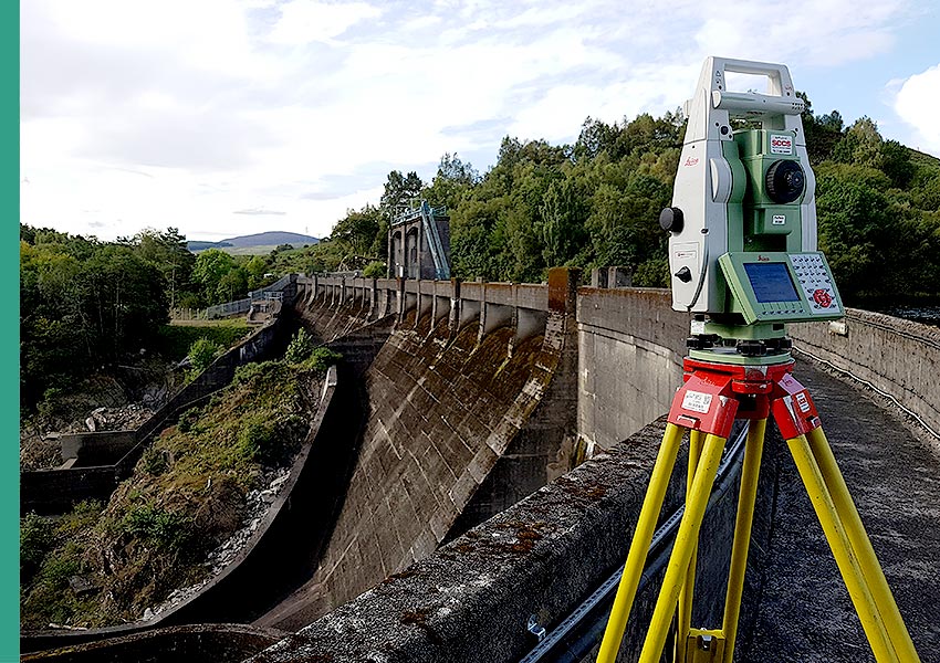
Surveying infrastructure and assets in a Hydro plant at pre construction and post construction stages can provide several benefits, including:

Safety: By regularly surveying and inspecting utility systems, potential safety hazards can be identified and addressed before they lead to an incident thus reducing project risk.

Asset Management: By surveying the utilities it can be better understood the usage, performance and capacity of the utilities, and the maintenance plan can be optimized accordingly.

A hydro power plant.

Our solutions_

GEOSPATIAL CONSULTING

Our Geospatial Consultancy provides our clients with the expertise on geospatial technologies and processes to enable them to leverage accurate and timely location-based data. We develop a bespoke geospatial management plan that detail out specific process and standards to ensure geospatial data is verified and trusted.

  • Geospatial Consulting
  • Geospatial Management
  • Feasibility studies
Geospatial-Consulting

GEOSPATIAL MAPPING

We collect spatial data of new and current assets in order to provide comprehensive records and information on an asset for anything from data analysis to design to support digital processes. This includes 3D data for design and accurate mapping of buried utilities to prevent service strikes.

  • Survey Control Networks
  • Topographic Mapping
  • Utility Mapping
  • Reality Capture
  • 3D modelling – GeoBIM
  • GIS
  • Site Verification
Maping

GEOSPATIAL ENGINEERING

Our Geospatial Engineers have experience in working on high rise and modular buildings. Axial Shortening, Vertical Control and Lift Core structural monitoring are all critical elements to ensure that high rise buildings can be built to tolerance and preventing associated issues during construction.

  • Survey Control
  • Setting Out
  • As-Built Verification
  • Progress visualisation
  • Lift Jack monitoring
  • Axial Shortening
  • Setting out for Modular construction.
Geoaspatial-Engineering

OTHER

Geospatial solutions are not limited to the subsectors shown here. Get in touch to find out how we can help you.

More
case studies_

We have helped our clients across various sectors make informed decisions in projects. View our case studies.

No data was found

Get in
touch
_