
Our
projects_
PROJECT
The Old War Office, UK
Client
> Westminster Development Services Ltd
>Property
>Heritage
>3D Laser Scanning
> BIM
> Verification Surveys
>Digital Capture - Level 0
> Digital Capture - Level 1
> Digital Capture - Level 2
> Digital Capture - Level 3
> Digital Capture - Level 4
> Digital Capture - Level 5
Location
> Westminster, London, UK
Project summary
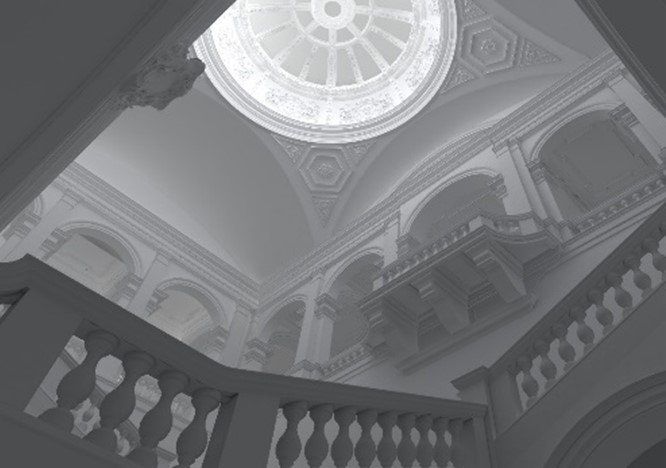
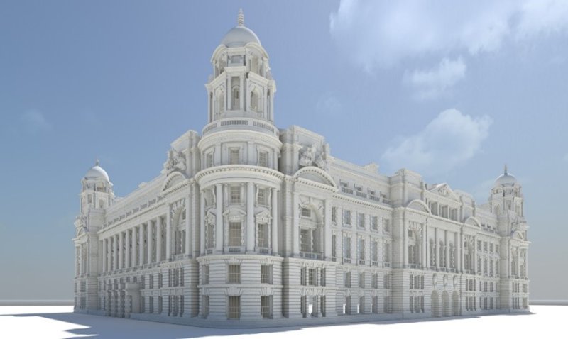
Following the successful delivery of an initial Scan-to-BIM model for early design purposes, Murphy Geospatial have maintained an ongoing survey involvement at the Old War Office spanning over 6 years. Numerous individual surveys have been undertaken during this time to inform various RIBA stages of the design, strip-out, demolition, refurbishment and construction of the new hotel and apartment complex set to open in 2023.
Our work
A number of Geospatial services have been utilised at the site over the six-year period, including but not limited to:
- Initial scan-to-BIM model and detailed CAD drawings of the building immediately following the sale of the property
- Panoramic imagery survey to provide visualisations of the site
- A progressive upgrading of the BIM model to a higher level-of-detail (LOD)
- Topographical and underground utility survey of the site surrounds
- Updating of the BIM model during strip-out works by maintaining a permanent site presence
- Photographic dilapidation survey for the main demolition contractor
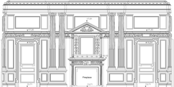
- As-built CAD drawings incl. internal elevations for final fit-out purposes
- As-built 3D verification survey of the complex pavilion structure for final fit-out purposes
All surveys have been accurately aligned to a common grid and level datum established by Murphy Geospatial at the outset of the works; providing the client and design team with geospatial certainty across all services and deliverables.
The challenges
The multiple projects at the site over a six-year period formed a number of challenges:
- The initial laser-scan survey was undertaken whilst the property was still partially occupied by the Ministry of Defence (MoD). Numerous measures were implemented for security purposes such as full escorts whilst on site and image editing for the redaction of sensitive information.
- The initial BIM / Revit model was produced to a basic specification for initial structural design only. Additional details, such as the heritage artefacts, were progressively added to the model over several iterations which causes many technical challenges within Revit software.
- Due to the size of the site and complexity of the models, the singular model file became too heavy to be used as an effective design tool. Efforts were made to split the model into various files and work sets to ensure the usability of the model deliverables.
- During demolition works, to ensure changes on site were reflected in the Revit model, Murphy Geospatial maintained a permanent presence on site to provide the client with near ‘live’ updates to the model and ad-hoc geospatial information to suit the asset owners requirements.
- A dilapidation imagery survey was required by the main strip-out contractor as evidence of defects prior to their involvement on site. This presented a challenge of ensuring that all features and surfaces were covered by the photography, resolved using a 360 panoramic camera to ensure full coverage and an online interface that all stakeholders could access and use.
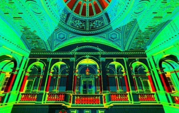
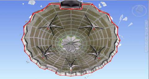
- Verification against design of the ‘pavilion’ proved challenging due to the highly irregular shape and form of the pavilion structure (see right-hand image below of the pavilion ceiling). 3D laser scanning was utilised to capture the as-built structure and a 3D analysis undertaken in Navisworks to assess the accuracy of the build compared to the complex 3D shapes within the design model.
Results
The asset owner at this prestigious development has engaged Murphy Geospatial across numerous surveys at the site over a number of years. Our numerous deliverables have provided the design team with the ‘Geospatial Certainty’ they required to inform critical decisions at such a large, prestigious and complex site. Various challenges have been overcome to ensure the timely delivery of geospatial data for a wide range of stakeholders involved across the full lifecycle of the design and construction process.
Client Testimonial
“We used Murphy Geospatial at The OWO for numerous surveys across several years of the development, and I have been impressed by their reliability and accuracy. Their wide range of services has been particularly beneficial, including BIM modelling, construction validation, photographic surveys, and utilities, and they have always delivered high-quality results. I appreciate their quick turn-around time, especially during the construction and final fit-out stages when time is of the essence, and highly recommend this company for a dependable survey service”
Contact
For more information on this project, please email info@murphygs.com or call us on +44 (0)192 362 4800
For further details of the Old War Office development please see here.