
Our
projects_
PROJECT
Luas Line, Monitoring, Dublin – Ireland
Client
> Walls Construction
Sector/Market
> Infrastructure
Services
> Monitoring – Ground Movement
Location
> Dublin, Ireland
Project summary
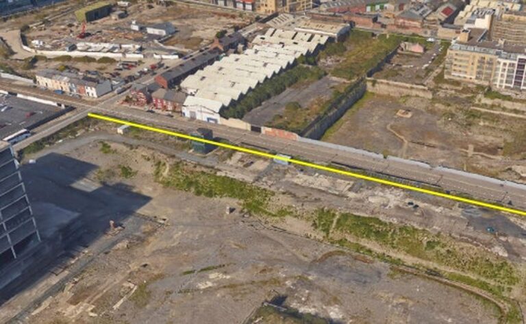
During a bulk excavation and installation of ground anchors of an existing pile wall, Murphy Geospatial were contracted to develop and implement a new methodology to provide a non-invasive continuous monitoring system in order to monitor an existing embedded light rail track system. Three fully automatic AMS (Automatic MultiStation) monitoring systems were used to monitor continuously track movement on Mayor Street Upper in conjunction with vibration monitors, inclinometers, and Precise level observations.
The brief
- Monitor settlement of LUAS Railway tracks and report and alarm on exceeding predicted safety limits on Twist and Cant parameters
- Monitor vibration levels caused by bulk excavation and report and alarm on exceeding PPV (Peak Particle Velocity) levels in accordance with BS 5228-2:2009
- Monitor existing pile wall for deformation caused by bulk excavation and destressing of anchors of pile wall.

Our work
Client:
- Reduced cost to monitoring project – No monitoring targets/prisms required even though 800+m of light rail being continuously monitored for duration of project.
- Data reliability – Murphy Geospatial deal directly with infrastructure provider, TII (Transport Infrastructure Ireland), on client’s behalf.
Transport Infrastructure Ireland:
- Innovation – A first of its kind for continuous monitoring of any embedded light rail infrastructure
- Reliability and Redundancy – Reliable results backed up with redundant precise level measurements.
Early Warning – Should a failure have occurred Murphy Geospatial’s innovative solution would have provided all nominated parties with an immediate warning, prior to light rail entering failed zone, 24 hours per day, for the duration of the project.
Client Testimonial
“We recently engaged the services of Murphy Geospatial to undertake live monitoring of the Luas Line on a project in Dublin City Centre. Due to the proximity of the Luas lines to the double basement excavation, a detailed methodology and monitoring proposal was required. Shane and his team developed a methodology and carried out AMS track monitoring, precise level surveying, inclinometer readings and vibration monitoring during our works. Murphy Geospatial completed this work to a high standard from start to finish and we look forward to working with them again in the future.”
Owen Stynes, Project Manager, Walls Construction
Contact
For more information on this project, please email info@murphygs.ie or call us on +353 (0)1 690 9799