Construction of a data centre was planned on a 17-hectare green field site. The client required accurate geotechnical data, knowledge of bedrock depth and competence to select suitable designs for the foundations. The client also required a resistance dataset in order to design electrical pillars.
The brief
Murphy Geospatial was tasked to undertake a Geophysical survey to map the bedrock within the mentioned site.
The main objectives of the survey were to:
Assess the bedrock depth and competency.
Assess the thickness of each stratum above the bedrock.
Provide a 3D surface map of the bedrock.
Record a resistance dataset to aid with the design of electrical pillars.
All four of the objectives were met by respectively using Seismic Refraction, ERT (Electrical Resistivity Tomography) and a Resistance Survey. The final deliveries were geological interpretation sections and a 3D bedrock surface map, both in AutoCAD format, plus a resistance dataset.
The delivery of the 3D bedrock surface map, developed in-house, required the merging of the different datasets. It provided a global point of view shedding light on:
The spatial variation of bedrock depth.
The strike and profile of the bedrock.
The volume of soil above the bedrock.
Such information can later be used by the client for foundation design purposes and selection of excavation equipment.
The challenges
The site was actively being used by both a farmer and a Geotechnical survey crew while the geophysical survey was being undertaken. Murphy Geospatial coordinated with all stakeholders in order to gather the required data without disrupting the Geotechnical investigation and farm operations or damaging the crop.
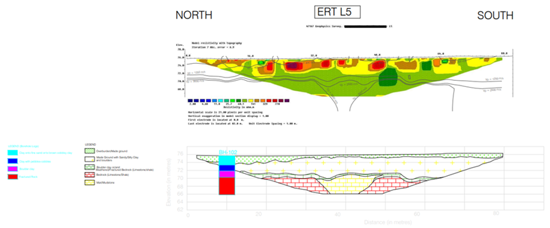
Great care was taken to align some of the geophysical lines along the drilling locations, with a view to calibrate seismic outputs to Geotechnical core samples.
Figure 2 Example of a geophysical line calibrated with a borehole log. There is a good match between both datasets. The strikethrough across the location name is for meeting confidentiality requirements.
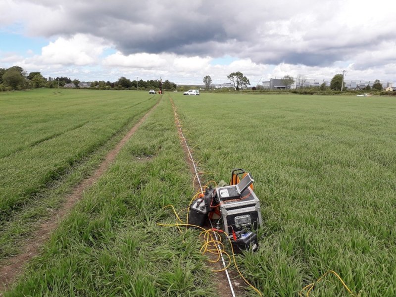
Figure 3 ERT acquisition being run on site. The crop was between the seedling and vegetative states.
Our work
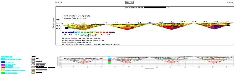
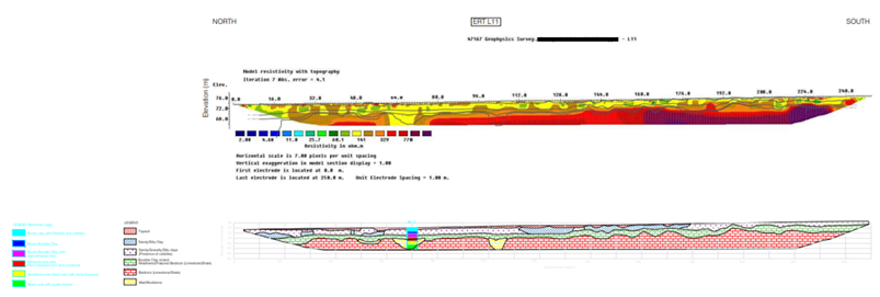
The conventional and established acquisition geometry consists of two steps: first, recording multiple geophysical lines on site, and after processing, assembling them to create one section. When the length of some lines exceeds 250m in length, this traditional approach leaves multiple blind zones, as depicted in this image:
Figure 4 Example of a deliverable, had the acquisition been recorded in the traditional way, i.e., had the section length been solely defined by the maximum number of geophysical devices (either electrodes or geophones). There is no possibility to spot bedrock depth variations and irregularities within the gaps between sections. For this reason, this solution was not deemed as acceptable by Murphy Geospatial
As can be seen in the image above, the initial data acquisition only provides a partial dataset which may not capture sudden bedrock variations and irregularities, or other buried features. An undetected feature is sometimes trivial but can also have more important consequences on a construction project.
To alleviate this issue, Murphy Geospatial employs a method of capture known as “roll-along”. In doing so, extra time is taken for gathering all the data required to produce a complete section of the subsurface and significantly reduce the possibility of important features being excluded. The acquisition is certainly longer, but it significantly reduces the risk of delays and cost implications for the client during the construction phase of the project
Figure 5. The same section as shown previously but recorded in roll-along mode. Within Murphy Geospatial, both Seismic Refraction and ERT are recorded in roll-along mode by default. However longer to record, this mode covers the bedrock overall the 250m length of this line. This extra effort further guarantees the client that no sudden lateral change will unexpectedly affect the construction project.
After processing, seismic, ERT and geological interpretation sections were delivered in AutoCAD format. The resistance dataset was delivered in a separate report. Then, all measured bedrock depths were interpolated between geophysical lines for the final deliverable, the 3D bedrock surface map. All of the results were then cross-referenced against the results from Geotechnical investigations to validate the survey results.
Results
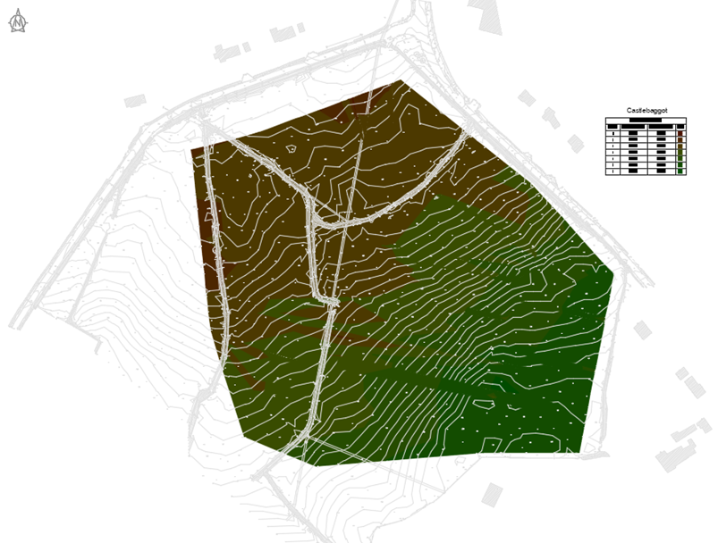
A 3D bedrock surface was generated from the combination of the bedrock measurements of the different profiles and Geophysical methods. It underlines the general trend of the bedrock, which gradually slopes from South-East (Upper elevation) to North-West. This observation is also in agreement with the geological bedrock map from www.gsi.ie, and the results of geotechnical investigations undertaken at the same time as the survey.
The bedrock map provides a global point of view of the site. This could not be achieved without the use of the roll-along method to capture the dataset. Murphy Geospatial was able to provide the client with excellent results by combining multiple geophysical techniques and cross-referencing other available information, then taking a global view to produce an accurate 3D bedrock map in AutoCAD format.
This provided the client with information to assess the volume of soil and enabled the client to make an informed decision when choosing excavation equipment and techniques and, to gain a better understanding of expected costs and durations for the excavation.