Our
projects_

Featured Image - Geophysical Survey - Germany

PROJECT

Geophysical Survey, 25ha Green Field, Germany

Client
> Confidential

Sector/Market
> Infrastructure, Utilities

Services
> Subsurface Surveys, Geophysical Surveys

Location
>  Germany

Project summary

Our client required a Geophysical Survey of a 25ha open-field site in Germany, making an informed decision on a potential location for a new data centre. They needed to confirm the subsurface soil strata and understand what lies beneath the ground to ensure that the site was suitable before any construction works commenced.

The brief

Murphy Geospatial was consulted in this project, to provide geospatial data to help identify potential hazards and ensure that the soil types were identified. This aided the client in designing, building foundations and planning the electrical scheme of the project.

The client requested a complete survey involving:

  1. Seismic Refraction and ERT (Electrical Resistivity Tomography), for assessing the loess thickness above the sand layer.
  2. An EM (electromagnetic) mapping survey for detecting the presence (or confirming the absence) of utilities on this site.
  3. A resistance soil resistance survey, required for designing electric pillars.

The challenges

We needed to ensure that all bedrock and buried features were captured accurately to provide a full picture of the subsurface strata, helping to avoid any issues when construction works begins.

Our work

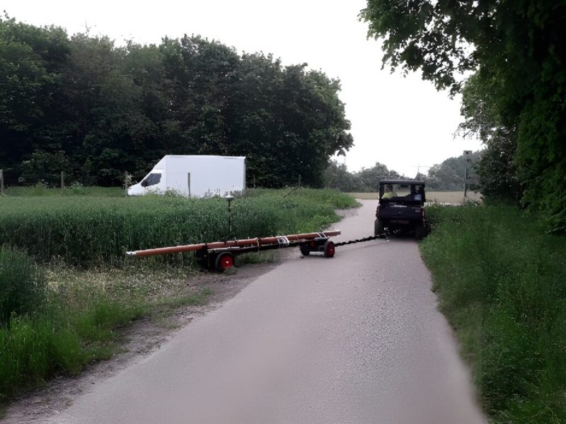
The size of the field, combined with the management of a Geophysical Survey, opened the possibility to run different geophysical methods simultaneously across the site. Quality Control was undertaken on site daily throughout the survey to ensure the data was of suitable quality to meet the client’s requirements.
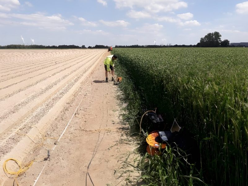
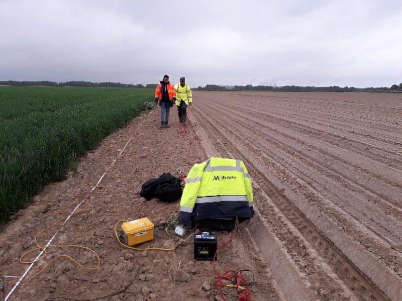
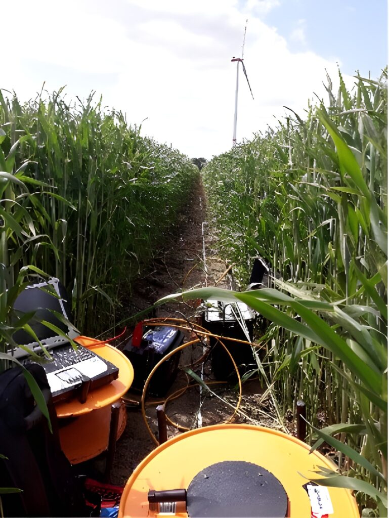
Seismic refraction and ERT acquisitions at different stages of the survey - Image 1
Seismic refraction and ERT acquisitions at different stages of the survey - Image 2
Seismic refraction and ERT acquisitions at different stages of the survey - Image 3
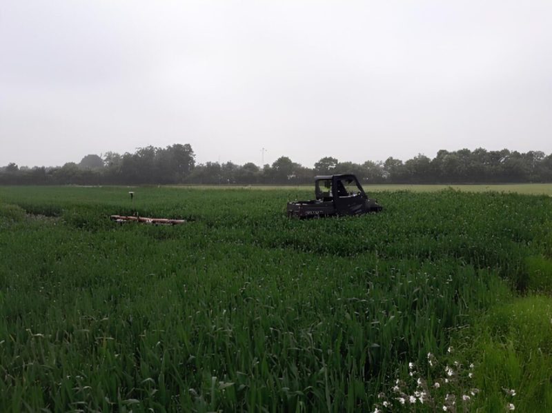
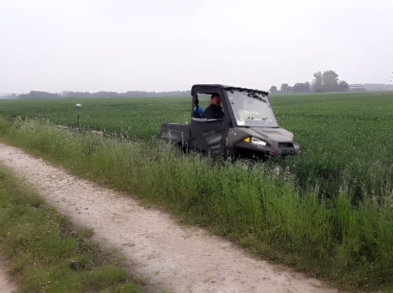
EM acquisition at different stages of the survey - Image 1
EM acquisition at different stages of the survey - Image 2
EM acquisition at different stages of the survey - Image 3
Geophysical Survey, 25ha Green Field, Germany
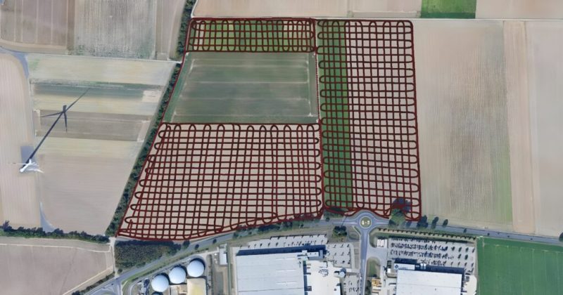
Example of EM Explorer coverage, thus verifying that no part of the field was missing

Multiple geophysical lines were recorded on site. Seismic and resistivity acquisitions were run side by side, with some lines exceeding 500m in length. A first acquisition method would consist of letting the maximum number of geophysical devices (shall they be electrodes or geophones) define the length of a geophysical section. Then, the assembling of each section would lead to the following result:

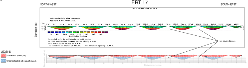
Example what a final deliverable would look like
Example what a final deliverable would look like, had the section length being solely defined by the maximum number of geophysical devices (should they be either electrodes or geophones). There is no possibility to spot the different layers’ depth variations and irregularities within the gaps between sections. For this reason, this solution is not deemed as acceptable within Murphy Geospatial.

Such a solution leaves gaps between sections, into which a sudden bedrock variation, irregularity, or other buried feature, could be left undetected. An undetected feature is sometimes trivial but can also have more important consequences on a construction project. Therefore, at Murphy Geospatial, extra recording time is systematically used for mapping the gaps between these sections. The result is a bedrock properly delineated along the entire length of the line, regardless of the number of electrodes or geophones.

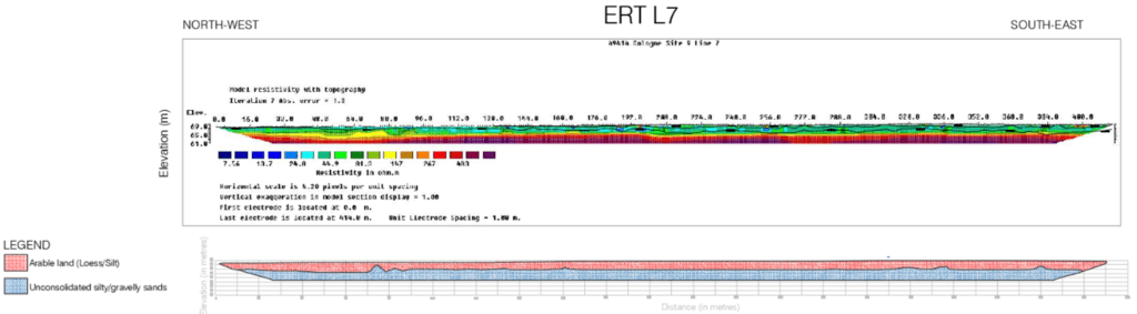
Same section than above, but how it was recorded
Same section than above, but how it was recorded, i.e., in roll-along mode. Within Murphy Geospatial, both Seismic Refraction and ERT are recorded in roll-along mode by default. However longer to record, this mode covers layers over all the 410m length of this line. This extra effort further guarantees the client that no sudden lateral change will unexpectedly affect the construction project.

Our team

The Subsurface Engineering team successfully completed the project utilising up-to-date technologies and best practises from over 40 years of experience in the geospatial industry.

Results

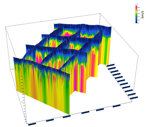
A seismic cube was assembled for determining the general geological trend of this site. This interpolation between lines merges the dataset, and therefore, summarises the information of this site, enabling the client to make data-driven decisions to reduce any potential risks and costs. It is useful for getting the general trend of:

  • The loess layer thickness’ spatial distribution
  • The strike and dip of the underlying sand layer

SEISMI~1
Seismic lines compiled in a seismic cube. Coordinates are hidden for meeting confidentiality requirements.

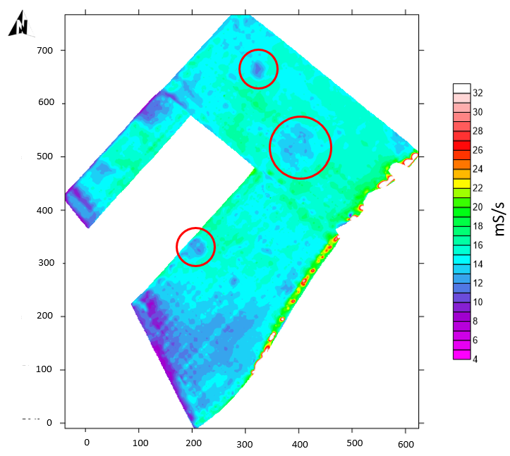
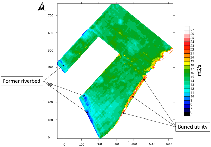
EM-Explorer dataset was mapped for tracking the eventual presence of utilities on this site. While detecting one buried utility, multiple anomalies also matched known present and past features on-site.

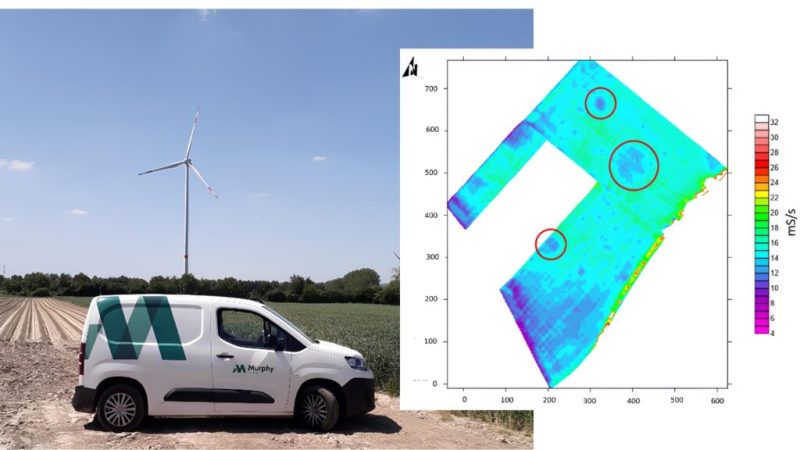
Low amplitudes circled in red are known craters from WWII
Low amplitudes circled in red are known craters from WWII, and already surveyed by a company specialised in the search and recovery of unexploded ordnances (UXO). Coordinates are partially or totally hidden for confidentiality reasons.
Same EM-Explorer map
Same EM-Explorer map, but with a different colour-scale for underlining former riverbed and buried utility features. Coordinates are still partially or totally hidden for confidentiality reasons.

Contact

For more information on this project, please email info@murphygs.ie or call us on +353 45 484 040